Nipen (227 m a.s.l.) and Festvågtind (541 m a.s.l.)
In this article, we will describe in detail two popular trails with views of Henningsvær town. If you haven't seen our Lofoten guide article yet, we'll leave you a link to it right away. You'll find practical information about transport, accommodation, tips, and other places worth visiting on Lofoten.
Lofoty - guide
Part I - practical guide to the Norwegian archipelago - transport, accommodation, and advice on preparing for travel!
Table of contents:
Nipen and Festvågtind
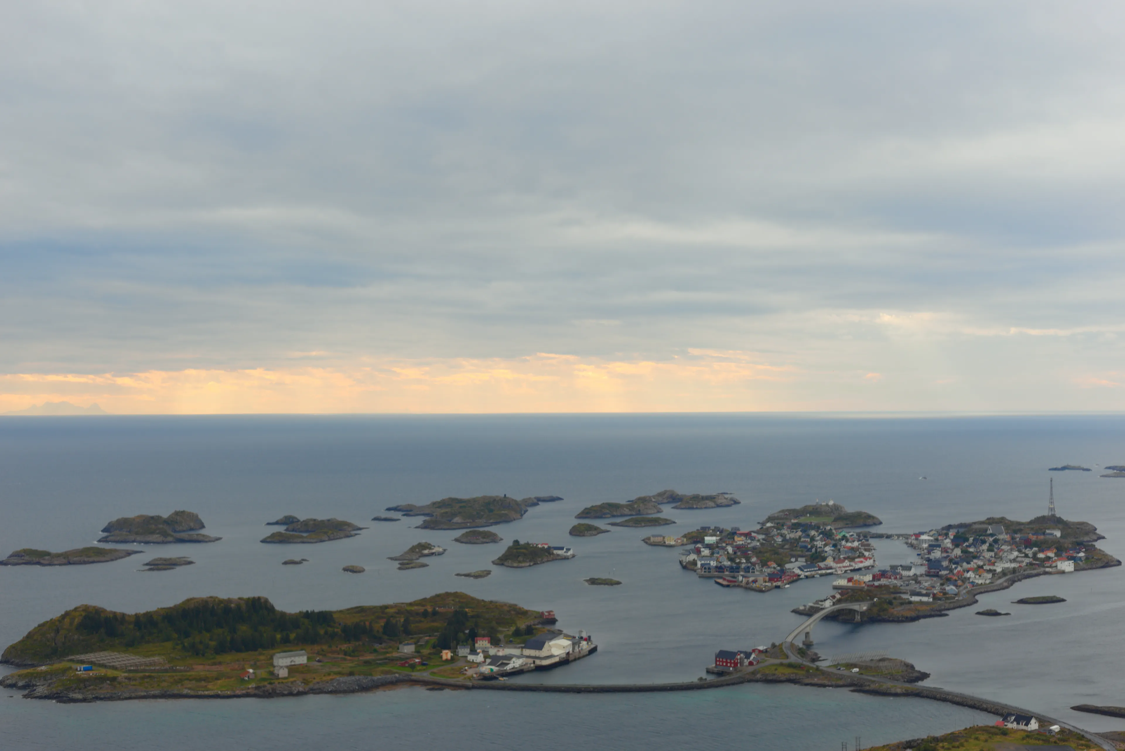
Two peaks located right above Henningsvær (link to our article). In our opinion, they are among the must-visit points during a trip to Lofoten. It is from their summits that the famous photos are taken from above of the characteristic football field, located at the end of the town on one of the islands. No wonder it gets crowded here in season, as these are some of the most recognizable spots in the entire archipelago. Both peaks lie next to each other and have partially shared paths leading to them. So you can decide whether you want to climb the lower Nipen (227 m a.s.l.) or try your skills on the higher and more demanding Festvågtind (541 m a.s.l.). Looking from Henningsvær town, the towering Festvågtind immediately catches the eye, looking very intimidating from this perspective. Next to it is visible the smaller but equally picturesque Nipen. From both, a magnificent panorama of the archipelago unfolds.
Parking
You can leave your car at a free parking lot about 200 m from the trail entrance 68.170053, 14.221048. It's small and fills up quickly. An alternative is a paid parking lot a bit earlier 68.171035, 14.214103 or the large parking lot right in front of Henningsvær, which we mentioned in our guide.
Nipen Trail
- Trail length:
- 591 m
- Duration:
- 30 min
- Elevation gain:
- 180 m
- Difficulty level:
- medium
Trail Description
The Nipen trail starts about 200 meters from the mentioned parking lot. The initial section leads along a steep, rocky path that can be quite slippery and require caution in rainy weather. As the altitude increases, the first views of Henningsvær and the surrounding islands quickly begin to appear. After about 20-30 minutes of ascent, we reach Lake Heiavatnet, where the trail forks - the path to Nipen goes to the right, and to the higher Festvågtind to the left. The further part of the route to Nipen is much gentler and leads along a short, fairly flat section to the viewpoint at the summit. From here, a beautiful panorama unfolds over Henningsvær town, the characteristic football field, and the surrounding peaks and sea. This is an ideal place for a short trek if you're looking for a shorter and quieter alternative to Festvågtind, but with an equally spectacular view.
Festvågtind Trail
- Trail length:
- 1.0 km
- Duration:
- 1:17 h
- Elevation gain:
- 510 m
- Difficulty level:
- medium
Trail Description
The Festvågtind trail starts the same way as the route to Nipen. Only at Lake Heiavatnet do the trails fork. To climb Festvågtind, you need to turn left. From this moment, the path begins to climb steeply uphill again over rocks, and the terrain becomes more demanding. The higher you go, the more exposed and prominent the trail becomes, making it more vulnerable to wind. On wet rocks, it's worth being especially careful, as it can be slippery in places. With each step, the views become increasingly spectacular, and below unfolds a panorama of Henningsvær, its famous football field, islands, and the surrounding sea. From the summit of Festvågtind (541 m a.s.l.), one of the most characteristic panoramas of the entire Lofoten archipelago stretches out.
Summary
We decided to climb only Nipen because the weather started to deteriorate, and rain would have made climbing Festvågtind dangerous. The entire route to Nipen and descent took us just over an hour. We walked a total of 2.4 km (including the walk to the parking lot). The trail is not particularly demanding physically and is perfectly suitable for a shorter trip.
Seasonality
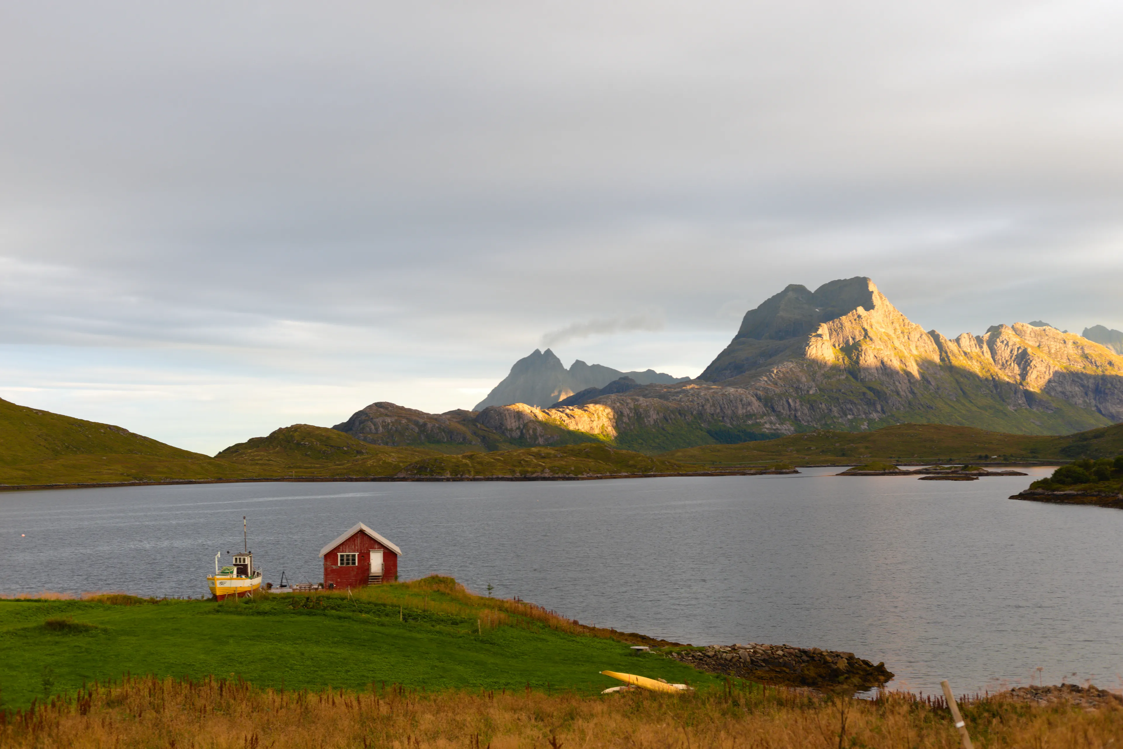
In the summer season, if weather conditions are good, the trail is safe, though it can get crowded. In spring and autumn, the route can be muddy, and in higher parts, patches of snow may remain. Good trekking boots, poles to facilitate the ascent, and caution during descent are needed. However, in winter, climbing is possible but only for experienced people with appropriate equipment. The path is steep and icy, which creates great danger.
Frequently asked questions
Should I climb Nipen or Festvagtind?
The two peaks sit side by side above Henningsvaer and share part of the path. Nipen is the lower, easier option at 227 m, while Festvagtind is higher and more demanding at 541 m. If you want the classic view over Henningsvaer without a hard climb, Nipen is enough; Festvagtind rewards stronger hikers with a loftier panorama.
How long and how hard are the Nipen and Festvagtind trails?
Both are rated medium. The Nipen trail is short - about 591 m long with 180 m of elevation gain, roughly 30 minutes up. Festvagtind is about 1 km with 510 m of elevation gain, around 1 hour 17 minutes up. Nipen up and down took us just over an hour, 2.4 km including the walk from the parking lot.
Where do you park for Nipen and Festvagtind?
There is a small free parking lot about 200 m from the trailhead, at 68.170053, 14.221048, but it fills up quickly. Alternatives are a paid lot slightly before it at 68.171035, 14.214103, or the large parking lot right in front of Henningsvaer.
Why are Nipen and Festvagtind so popular?
These peaks give the famous bird's-eye view of Henningsvaer's football field, set on a small island at the edge of town - one of Lofoten's most recognizable sights. Both summits open a magnificent panorama over the archipelago, which is why the trails get crowded in season.
When is the best time to hike Nipen and Festvagtind?
In summer the trail is safe in good weather, though busy. In spring and autumn it can be muddy with patches of snow higher up, so bring good boots and poles. In winter the ascent is only for experienced hikers with proper gear - the path is steep and icy, which makes it dangerous.
And if you want to stay up to date with more travel inspirations, check out our Instagram!
@journeysjar