Blåtinden (604 m a.s.l.)
Blåtinden (604 m above sea level) is a little-known peak on Vestvågøya island near Leknes in Lofoten - perfect if you want quiet and a panorama without the crowds. The loop is about 5-6 km and takes roughly 2 hours; it's technically easy, though unmarked and muddy. It looks its best at a September sunset.
In this article, we will present our mountain discovery. This is because we didn't come across this peak in many guidebooks, and we found it ourselves while browsing maps. However, the charming trail and spectacular views from the top made a huge impression on us. That's why we want to share it with you!
But for those who are here for the first time, we also have an invitation to our article - a guide to the Lofoten Islands, where we included many practical tips regarding transportation, accommodation, and other interesting places to visit in the Lofoten Islands.
Lofoty - guide
Part I - practical guide to the Norwegian archipelago - transport, accommodation, and advice on preparing for travel!
Table of contents:
Blåtinden 604 m a.s.l.
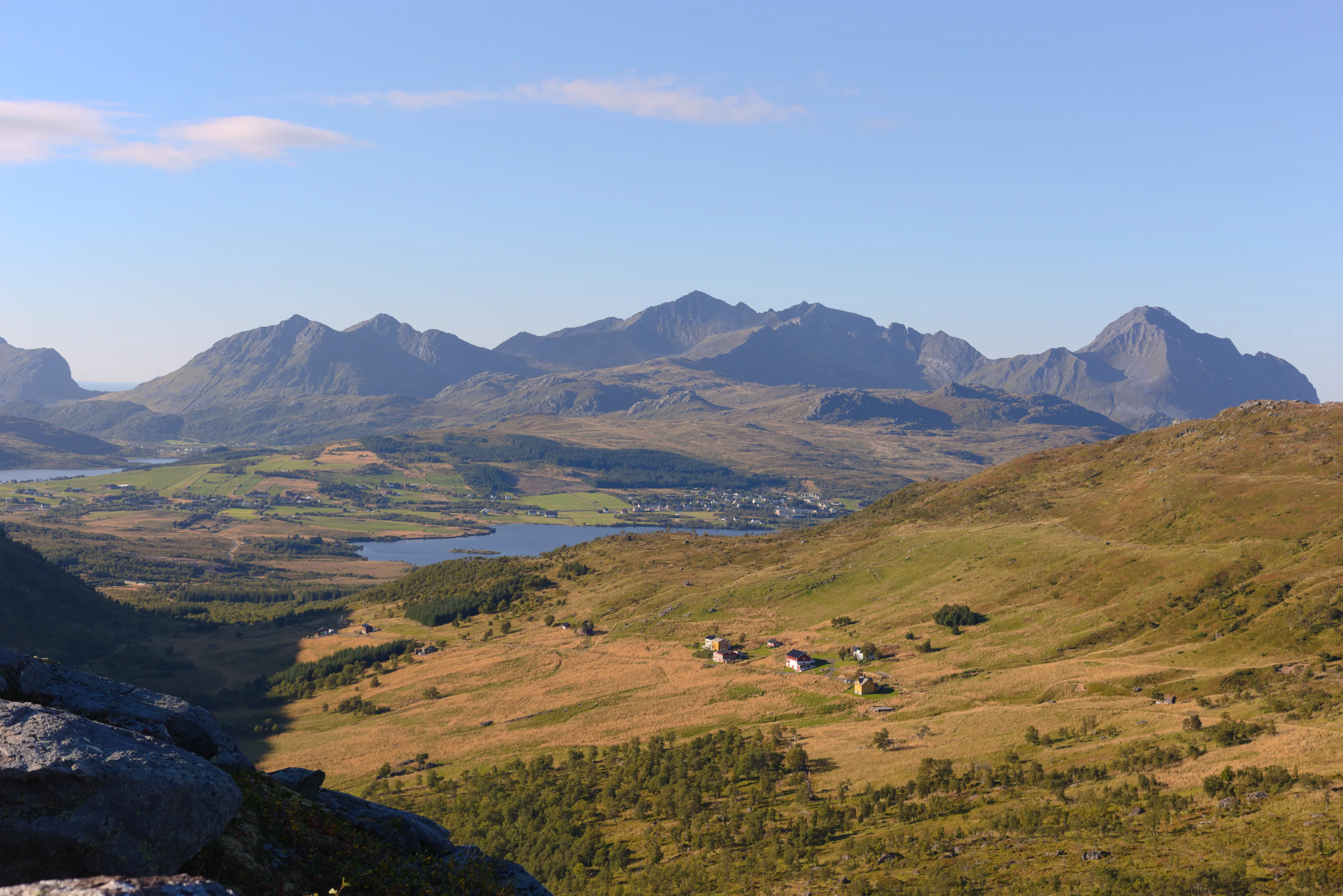
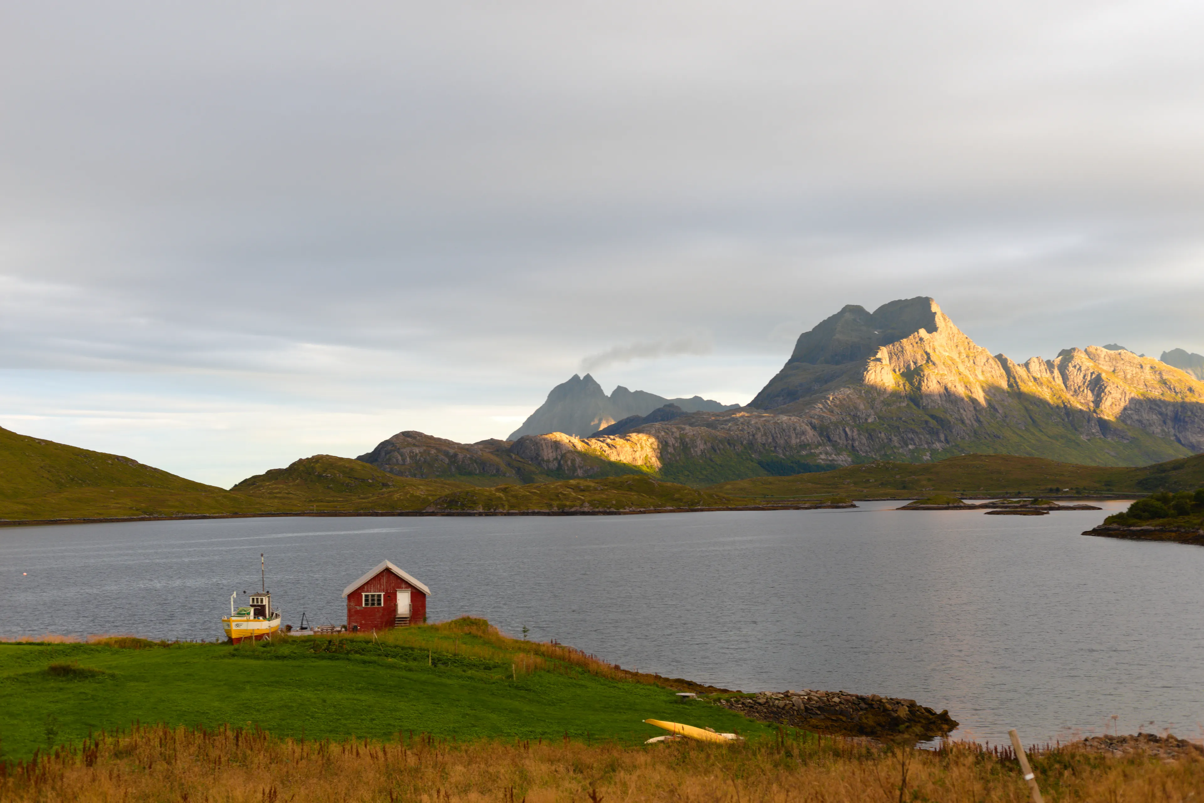
The peak is located on Vestvågøya island, near Leknes. It's important not to confuse it, as there are quite a few peaks with the same name in Norway itself. As we mentioned, there was very little information about it in Polish guidebooks, but we decided to climb it anyway. We came here out of curiosity and quickly realized it was a great decision. The summit is located at an altitude of 604 m a.s.l., and the views from the top are truly impressive. The panorama encompasses the entire vast Vestvågøya island, the calm waters of the Norwegian Sea surrounding it, and the characteristic flattening around Leknes where the main E10 road runs. It looks particularly beautiful during a September sunset, when the light softly emphasizes the shapes of mountains and valleys. The peak is not very popular, so you can count on peace and quiet here. We were completely alone at the top. It's an ideal place if you're looking for a less frequented trail with truly spectacular panoramic views.
Trail to Blatinden
- Trail length:
- 4,9 km
- Duration:
- 2:05 h
- Elevation gain:
- 418 m
- Difficulty level:
- easy
Parking
The trail starts in Slydalen. The entrance to the road is paid (information on the sign at the entrance). You need to drive to the end of the gravel road. At the last cottage there is a place to leave the car and immediately there is an entrance to the trail 68.217895, 13.799992.
Trail Description
The trail starts from the parking lot. We immediately enter through a gate onto sheep grazing land. The route largely leads through muddy terrain, so it's not a good trail after heavy rainfall. Even when the weather has been sunny for several days, the trail is quite wet. We start trekking on a designated path upwards. The trail is not marked, you have to follow the worn paths, which are easy to lose. The maps show us two routes to reach the main red trail. At the fork we also have a signpost. The route to the right (to Hagskaret) is wilder and steeper but shorter, leading through low birches. The route straight ahead (to Brattflogan and Rolvsfjord) is longer, with several boardwalks appearing on it, but it's just as muddy as the other one. We took the trail to the right into the path between the birches. However, choosing the trail straight ahead we will pass several laid boardwalks, until we again reach the fork that connects with the red trail. Here there is also a signpost, after which we head right to Blåtind and Hagskaret. Right next to it is a small shelter covered with grass. Inside there is only a fireplace surrounded by benches. Outside there is also a fireplace. You can stay here overnight. Behind the shelter we head up again, until we reach a clearing where the trail we wrote about earlier (the one leading through birches) meets the red trail, and the trail flattens for a moment. Then only ⅓ of the trail leading upwards remains. The last section of the route leads quite steeply over rocks. The climb is not very technically demanding, but you should watch out for loose stones. At the summit, with beautiful weather, all that remains is to enjoy the views. From the top you can see the nearby peaks, as well as the entire width of the island. Going down, you can return by a different route than we went up, as shown on the map above. We visited this peak in early September in the afternoon hours and met only two people on the trail. In our opinion, the trail was very charming and interesting, and the views were worth seeing. From this trail you can also go to the popular Justadtinden peak, but the hike there will take you much more time.
Summary
During our trekking we covered less than 6 km, which took us about 2 hours. We made the small loop mentioned earlier, occasionally getting slightly lost in the dense birch forest. Despite this, the trail turned out to be very pleasant, and along the way there were many places with beautiful views. This is one of those trails that are neither long nor particularly demanding, but give great satisfaction from hiking.
Frequently asked questions
How long does the hike to Blåtinden take?
The hike to Blåtinden takes about 2 hours, and the full loop is roughly 5-6 km with 418 m of elevation gain. It's technically easy and not too long, but the last section climbs steeply over rocks, so basic fitness helps.
Is the Blåtinden trail difficult?
The trail is technically easy but has two catches: it's unmarked (you follow beaten paths that are easy to lose) and it's often very muddy, even after several sunny days. The final part is steep rock with loose stones, so good boots help.
Where does the trail start and where do you park?
The trail starts in Slydalen. The access road is paid (see the sign), and you need to drive to the end of the gravel road. There's a spot for your car by the last cabin, with the trailhead right there (68.217895, 13.799992).
What makes Blåtinden special?
Blåtinden (604 m above sea level) is a peak on Vestvågøya island near Leknes. Note: Norway has several peaks with this name. It stands out for its panorama of the whole island and the Norwegian Sea, and for the quiet - the trail is little used, and you'll often have the summit to yourself.
When is the best time to hike Blåtinden?
The best time is summer and early autumn. The terrain is muddy, so avoid the trail after heavy rain - it stays wet even in sunny weather. Early September brings beautiful soft sunset light and very few hikers on the trail.
And if you want to stay up to date with more travel inspirations, check out our Instagram!
@journeysjar