
Lysá hora in Czechia - Malenovice loop via the Satina waterfalls
Lysá hora is the highest peak in the Moravian-Silesian Beskids and one of the most popular mountains on the Czech side of the range, just a few dozen kilometres from the Polish border. Join us on a loop from Malenovice. The ascent follows green and blue trails through the forest, then a steep yellow trail that opens up the first views. In good weather, you can see as far as the Tatras from the summit. We also cover where to park, how to avoid Czech motorway vignettes and other routes up Lysá hora: from Ostravice, Krásná, Visalaje and the Šance reservoir. Let's go!
Table of contents:
Lysá hora
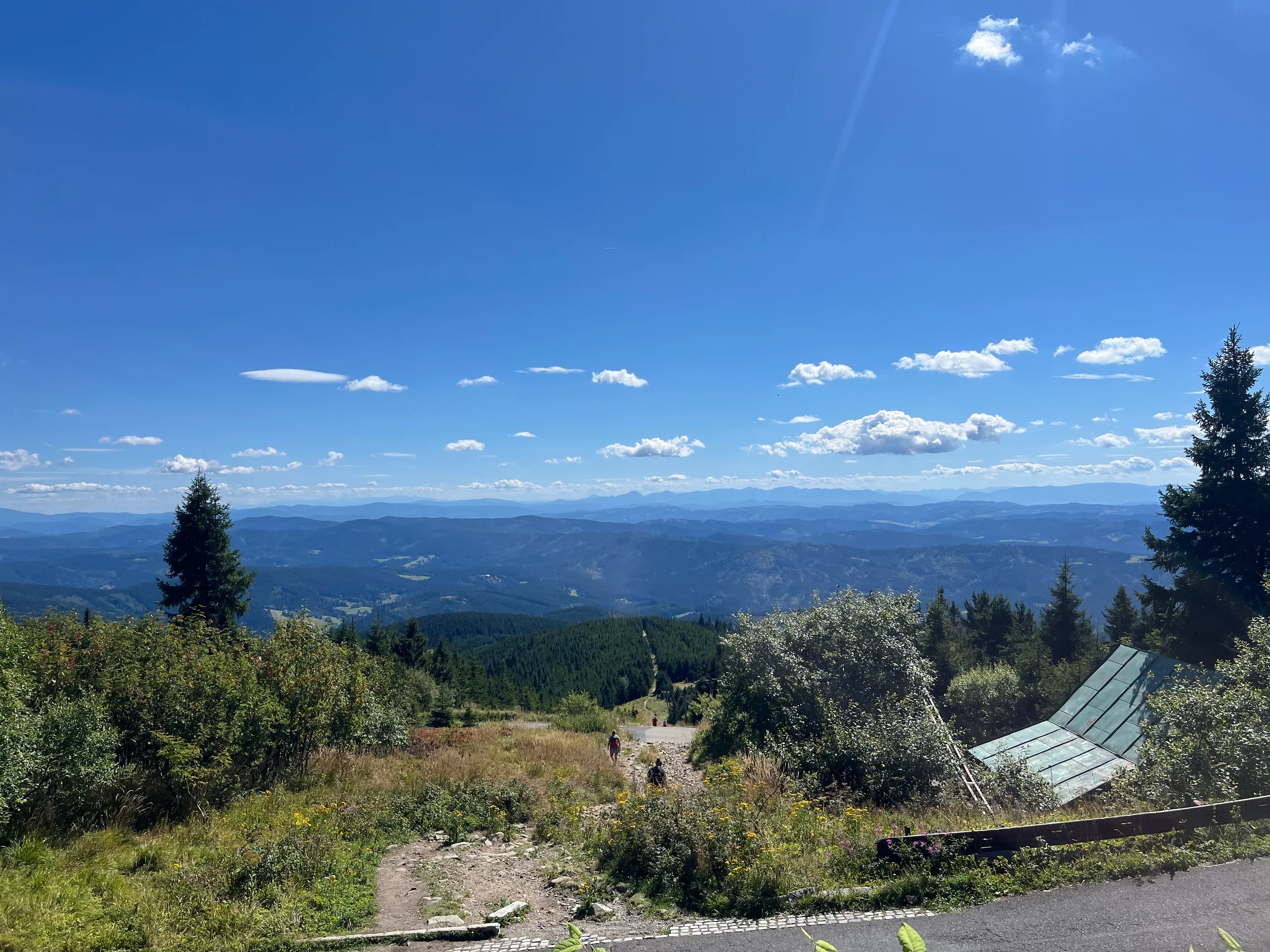
Lysá hora (1,323 m above sea level) is the highest peak in the Moravian-Silesian Beskids. The Czechs call it the queen of the Beskids, and it towers over the surrounding area. In clear weather, the summit offers views of the nearby ranges and Jeseníky, Malá Fatra, Veľká Fatra and the Tatras. The whole area lies within CHKO Beskydy, the Beskydy Protected Landscape Area.
Lysá hora owes much of its popularity to the wide choice of trails. Most hikers set off from Ostravice, Malenovice, Krásná or Visalaje, and the trails branch along the way, so you can easily choose a route to suit your fitness. You can also cycle up Lysá hora. An asphalt road from Papežov runs for just under 9 km with 720 m of elevation gain, making it a good option for cyclists.
The summit feels like a small mountain settlement. It has a weather station, a television transmitter, a mountain rescue station, three mountain huts and a small chapel beside Bezručova chata. The distinctive broadcasting mast is visible from far away on almost every trail. Horská služba is the Czech mountain rescue service, the counterpart of Poland's GOPR. A cross on the summit commemorates those who lost their lives on Lysá hora.
Before setting off, you can check conditions on the summit using the Czech meteorological institute's webcams.
Mountain huts on Lysá hora
There are two mountain huts on Lysá hora with restaurants and overnight accommodation. The most atmospheric is Bezručova chata, owned by the Czech Tourist Club (KČT). The original hut burned down on 11 March 1978, and the new one opened on 25 November 2015. Volunteers and fundraising helped rebuild it. Today's building is an almost exact replica of the old hut. In good weather, take a seat on the terrace for views of the Fatra mountains and the Tatras.
The hut has 5 double rooms with private bathrooms. A room costs 1,500 Kč per night, without breakfast. Bookings are by email only, and the kitchen serves meals until 19:30. Opening hours and current information are on the official website: Bezručova chata
The second hut is Chata Emil Zátopek – Maraton, named after the legendary Czech runner. It also offers accommodation and a restaurant. Outside, wooden tables overlook the distant peaks, with a deer statue nearby. Next door is the smaller Chata Emil Zátopka – Desítka, which provides more overnight accommodation. Details are on the website: Chata Emil Zátopek – Maraton
Sleeping in a tent
You can spend the night in a tent on Lysá hora. The hut and the Beskydy Protected Landscape Area administration jointly run a designated emergency overnight area. This is not a regular campsite. It occupies a strip of grass below Bezručova chata, marked in a photo on the hut's website. It can get busy in summer, as many people come to watch the sunset and then the sunrise. For details, contact the hut by email: Bezručova chata
Bear in mind that this is one of only a few such places in the Czech Beskids. Pitching a tent anywhere else in CHKO Beskydy is prohibited, and nature wardens can issue fines of several thousand Czech crowns. Similar overnight areas are available by the Skalka hut and at Pustevny.
Getting there and Czech motorway vignettes
Driving is the easiest way to reach the foot of Lysá hora. There is a large car park at the start of our loop in Malenovice, and from southern Silesia the drive takes just 1.5 hours. Check your route before leaving, though. Czech motorways use vignettes, with no toll booths where you can pay as you go. The shortest routes from Poland include toll sections, such as the D48 motorway beyond Český Těšín. Select ‘avoid toll roads’ in your navigation app and you will not need a vignette; the journey will not be much longer.
If you prefer to use the motorway, buy an electronic vignette before leaving from the official shop at eDalnice. The website also has a detailed map with toll sections marked in red and free sections in blue. The vignette is linked to your registration number, so there is nothing to stick on the windscreen. For a day trip, a one-day vignette is enough; it is valid until midnight on the day of purchase. Driving on a toll section without one can result in a fine of several thousand Czech crowns.
Route options
You can approach Lysá hora from four sides, and each trail branches further along the way. With so many options, it is easy to find a route that suits your fitness and the time you have. We chose a loop from Malenovice, which we describe in detail below. We have not walked the other routes, so we will not rate them. Each has a map showing the route, distance and walking time.
- From Malenovice, green and blue trails up Lysá hora - red, yellow and green trails back to Malenovice via the Satina waterfall (the loop we walked)
- From Malenovice, green and blue trails up Lysá hora - return along the same route
- From Ostravice, the red or blue trail up Lysá hora
- From Krásná, the yellow trail up Lysá hora
- From Visalaje, the red trail up Lysá hora
- From the Šance reservoir, red and yellow trails up Lysá hora (a loop)
Green and blue trails from Malenovice - a loop via the Satina waterfall
If you have followed us for a while, you will know we much prefer loops to retracing our steps. Lysá hora gave us plenty of options. We set off from Malenovice on the green and blue trails, followed by the yellow trail. We descended on the red and yellow trails past the U Veličků hut and took a detour to the Satina waterfall. That gave us forest climbs, an open slope with views, a busy summit and a quiet waterfall valley, all in one hike.
- Trail length:
- 12.5 km
- Duration:
- 5:11 h
- Elevation gain:
- 733 m
- Difficulty level:
- easy
- Dog-friendly trail:
- yes
- route without the shortcut
The map below shows our route using the shortcut (explained in detail in the route description)
Parking
The best place to leave your car is the car park beside the abandoned Petr Bezruč hotel in Malenovice, right at the start of our loop. All-day parking costs 100 Kč. There are plenty of spaces, but they fill quickly at weekends, so arrive early in the morning. Car park coordinates: 49.566962, 18.425354
Trail description
From the car park, we head straight into the forest on the green trail. We follow a woodland path for a while until the first junction. Here you can stay on the gentler green-marked route or take the worn shortcut we have marked on the map. The shortcut is much steeper. You will see more paths branching off later, but those sections are inside a nature reserve, where leaving the marked trail and taking shortcuts is prohibited.
the start of the green trail
the shortcut described above
After a solid climb on a narrow, rocky path through dense forest, we join the blue trail. For a short stretch the track is wider and gentler, before turning back into the woods onto a narrower path. We keep climbing until the next junction, where we continue following the blue markers. The forest gradually thins and more sunlight reaches us between the trees.
After another 4 km, we reach the junction at Malchor, where we get our first glimpse of the broadcasting mast on Lysá hora's summit. A few metres further on, the trail splits again. You can choose the shorter, steeper yellow trail or the longer, gentler blue trail. We take the quicker option. The yellow trail zigzags up the slope and soon emerges from the forest, revealing the towns in the valley below.
About 15 minutes later, we reach the broadcasting mast and head towards the official summit marker. Then we walk down to the hut, as this side of the summit has the best panorama. You can see the nearby Beskid peaks and, in good weather, the Tatras, Malá Fatra and Veľká Fatra. There are tables where you can have a mid-morning snack, or you can eat at the hut's restaurant.
After a short break, we head down on the red trail before switching to the yellow trail. It is a lovely stretch through tall woodland. Beyond the junction, there are fewer people around.
At Pod Lukšincem, we continue straight past the information board, following the yellow markers. We pass the U Veličků hut with its little shop, then stop briefly beside some large blackberry bushes. Beyond the hut, the trail follows an asphalt road.
At the Satina junction, we turn off towards the Satina waterfall. It is a short detour and well worth making, so do not miss it. We join the green trail and reach another junction. A short, steep climb on a rocky path follows. Watch the route carefully on the final stretch: at one point the green trail turns onto a rather overgrown, poorly marked path. This leads straight back to the Petr Bezruč hotel and the car park where we left our car.
Satina waterfalls
The Satina waterfalls (Satinské vodopády in Czech) are one of the best-known spots at the foot of Lysá hora. The Satina stream rises on the mountain's northern slope, at about 900 m above sea level, in the Lukšinec forest near the Malchor junction. The waterfalls lie above the Rajská bouda hotel in Malenovice and were already a popular destination in the 19th century.
Since 2006, the waterfalls have been protected as the Vodopády Satiny natural monument. It covers about a kilometre of the stream, which cuts through a rocky gorge up to 15 metres deep, with several waterfalls, steps and rapids. Geologists consider the rocky streambed one of the finest examples of its kind in the Czech Carpathians. Look for potholes: round hollows in the rock carved by swirling water and the stones it carries. The Lysá hora educational trail has led to the waterfalls since 2011, and paths and footbridges run through the gorge.
Do not expect huge cascades here. The Satina waterfalls are fairly low, and their popularity owes much to how easy they are to reach. You need to descend a little from the road to the stream and climb back afterwards, but the detour is worthwhile, especially on hot days when the shaded gorge stays pleasantly cool.
How our hike went
Our recorded loop came to 12.6 km with a total elevation gain of 941 m. We walked it in around 4.5 hours, excluding our breakfast stop on the summit.
We visited Lysá hora on the last warm weekend of the summer holidays, so there were plenty of hikers on the trails. The summit was crowded, with people arriving from every direction on foot and, in many cases, by bike. The descent was much quieter as everyone split off onto different routes. If you prefer peace and quiet, go on a weekday or start early in the morning. The views made the busy stretches worth it for us.
We liked how much variety this loop offered: climbs through the forest, views from the yellow trail on the open slope, a summit panorama reaching the Tatras, then a quiet valley and the Satina waterfall. At the end of the summer holidays, the trail was also full of wild berries, especially blackberries and bilberries.
Blue and red trails from Ostravice
- Trail length
- 14 km
- Walking time
- 5:42 h
- Elevation gain
- 878 m
Yellow trail from Krásná
- Trail length
- 10.4 km
- Walking time
- 4:45 h
- Elevation gain
- 800 m
Red trail from Visalaje
This route has the least elevation gain, as it starts high up. The trail begins beside the Visalaje hut, which has a car park. It follows the asphalt road to the summit, crossing it frequently.
- Trail length
- 16.7 km
- Walking time
- 5:56 h
- Elevation gain
- 660 m
Red and yellow trails from the Šance reservoir - a loop
The red trail climbs to the summit from near the Mazák bus stop. From the top, you can descend on the yellow trail towards the Šance reservoir, one of the largest in the Beskids. This is the longest and most demanding of the routes described here, which also makes it much quieter than the popular approaches from Ostravice or Krásná.
- Trail length
- 17 km
- Walking time
- 6:56 h
- Elevation gain
- 1039 m
Frequently asked questions
How long does the Malenovice loop up Lysá hora take?
According to the map, the loop via the Satina waterfalls on the green and blue trails covers 12.5 km, gains 733 m in elevation and takes around 5 hours 11 minutes. We recorded 12.6 km and walked it in about 4.5 hours, taking a shortcut but also making the detour down to the Satina waterfalls.
Where can you park in Malenovice for a hike up Lysá hora?
We left our car at the paid car park beside the abandoned Petr Bezruč hotel, where our loop begins (49.566962, 18.425354). All-day parking costs 100 Kč. There are plenty of spaces, but they fill up quickly at weekends, so it is worth arriving early in the morning.
Do you need a vignette to drive to Lysá hora?
No, if you select ‘avoid toll roads’ in your navigation app. The journey will not be much longer, and you will avoid the extra cost. You can check the toll sections on the official website, edalnice.cz.
Can you sleep in a tent on Lysá hora?
Yes, but only in one place. A strip of grass below Bezručova chata is designated for emergency overnight stays, run by the hut in cooperation with the Beskydy Protected Landscape Area administration. Pitching a tent anywhere else in the protected area is prohibited and can result in a fine of several thousand Czech crowns. Contact the hut by email for details.
Which is the easiest trail up Lysá hora?
The red trail from Visalaje has the least elevation gain because it starts high up, beside the Visalaje hut and its car park. It follows and repeatedly crosses the asphalt road to the summit, so the route is even and gentle. Our loop from Malenovice is also easy, but has steeper sections, especially on the yellow trail just below the summit.
Can you see the Tatras from Lysá hora?
Yes, when visibility is good. The best panorama is from the area outside the mountain huts, where you can see the Tatras, Malá Fatra, Veľká Fatra and Jeseníky as well as the nearby Beskid peaks.
And if you want to stay up to date with more travel inspirations, check out our socials!